
Field Data Collection
High-quality utility field data is critical for infrastructure decision-making.
Field Data Collection for Power & Broadband Infrastructure
Accurate field data is the foundation of modern power and broadband projects. From overhead power poles to underground fiber routes, nearly every engineering, permitting, and construction decision depends on knowing what actually exists in the field.
However, field data is difficult to collect at scale. Infrastructure is dispersed, access is inconsistent, and accuracy requirements are high. Small errors compound into redesigns, delays, and cost overruns.
This page outlines the major approaches used to collect power and broadband field data today, their tradeoffs, and how modern image-based workflows address many of these challenges.

Why Collecting Field Data is Hard
Infrastructure does not conform to clean digital models. Poles are located in ditches, back lots, alleys, and easements. Underground facilities often lack reliable as-builts or differ from recorded plans.
At the same time, inches matter. Clearance, attachment height, and route alignment require precision. Field data collection must balance accuracy, efficiency, and scalability. This is a combination that traditional methods often struggle to achieve.
Accuracy
Inches matter when surveying attachment heights and underground locations.
Efficiency
Decision-makers need in-depth field data without breaking the bank.
Scalability
Collection methods need to capture field reality once, without repeated site visits.
What “Field Data”
Actually Means
Power & broadband field data is often discussed as a single category, but in practice it includes distinct datasets for both overhead and underground infrastructure.
Overhead field data commonly includes:
Pole locations
Attachment heights and classifications
Span lengths and directions
Midspan clearances
Pole material and density
Surrounding context (roadways, vegetation, structures)
Underground field data may include:
Route geometry and alignment
Surface features and constraints
Access points, handholes, and vaults
Relationships to existing infrastructure
Both domains require spatial accuracy, visual context, and outputs that integrate cleanly into GIS and engineering workflows.

Common Field Data Collection Methods
There is no single “best” way to collect infrastructure data. Each method has advantages and limitations depending on scope, budget, and project goals.
-
Manual ground inspection remains the most traditional method. Fielders walk pole-to-pole, capturing photos, taking measurements with hot sticks or calibration sticks, and recording coordinates manually or in a fielding app.
This approach allows for close inspection and detailed observations, but it is slow, labor-intensive, and highly dependent on individual consistency. For large projects, costs and timelines scale quickly, and data must be processed from multiple formats into usable outputs.
Manual methods are most effective for small, targeted collections or locations that cannot be accessed by other means.
-
Some teams improve on manual methods by using calibrated measurement tools and/or mobile apps. These workflows reduce transcription errors and improve consistency, but they still require fielders to physically access each asset.
While accuracy improves, efficiency remains limited by walking speed, access constraints, and labor costs. For large-scale deployments, these methods can become cost prohibitive.
-
LiDAR creates dense 3D point clouds that capture entire environments, including poles, conductors, vegetation, and terrain. It is exceptionally powerful for applications like vegetation analysis, flood modeling, and structural studies.
However, LiDAR data is large, expensive to process, and often exceeds the needs of projects focused primarily on attachment heights, pole locations, or clearance checks. Point clouds do not inherently contain measurements; they require further analysis in specialized software.
LiDAR excels in high-detail, area-wide modeling, but it is often overkill for routine make ready or OSP workflows.
-
Aerial imagery from satellites, helicopters, or drones provides valuable overhead context. It is useful for route planning, mapping, and understanding spatial relationships.
However, aerial imagery alone typically lacks the resolution and perspective needed for precise height measurements or attachment analysis. Regulatory and cost constraints also limit its use for targeted data collection.
Aerial data works best as supplementary context, not a standalone solution.

The Scale Problem
Many traditional methods perform well at small scales but struggle when projects expand to cities, counties, or regions.
Walking every pole is accurate but slow.
LiDAR is comprehensive but excessive.
Aerial imagery is broad but shallow.
The industry’s challenge is not choosing a perfect tool—it is balancing accuracy, efficiency, and usability at scale.
This is where modern, image-based approaches have emerged.
A Modern Approach to Field Data Collection
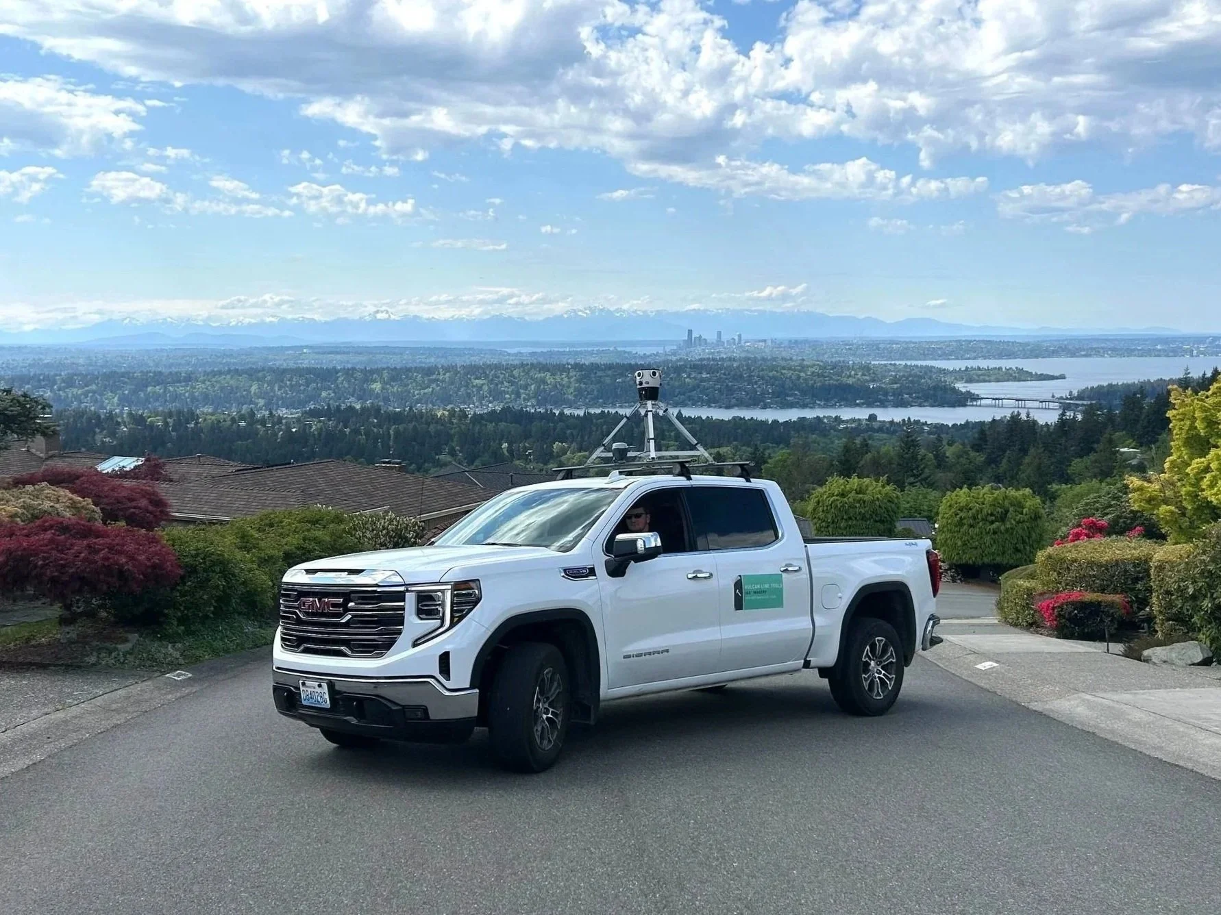
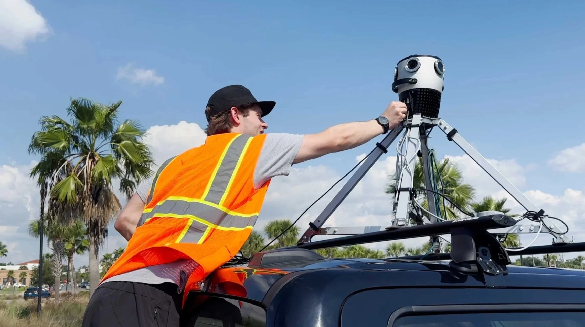
At Vulcan Line Tools, our approach is built around a simple principle: capture reality once, then extract data as needed.
Using vehicle-mounted 360° imagery and RTK-corrected GPS, large volumes of high-resolution visual data can be collected efficiently along infrastructure routes. This imagery preserves full field context and enables accurate measurement of poles, attachments, spans, and clearances directly within Azmyth, without repeated site visits.
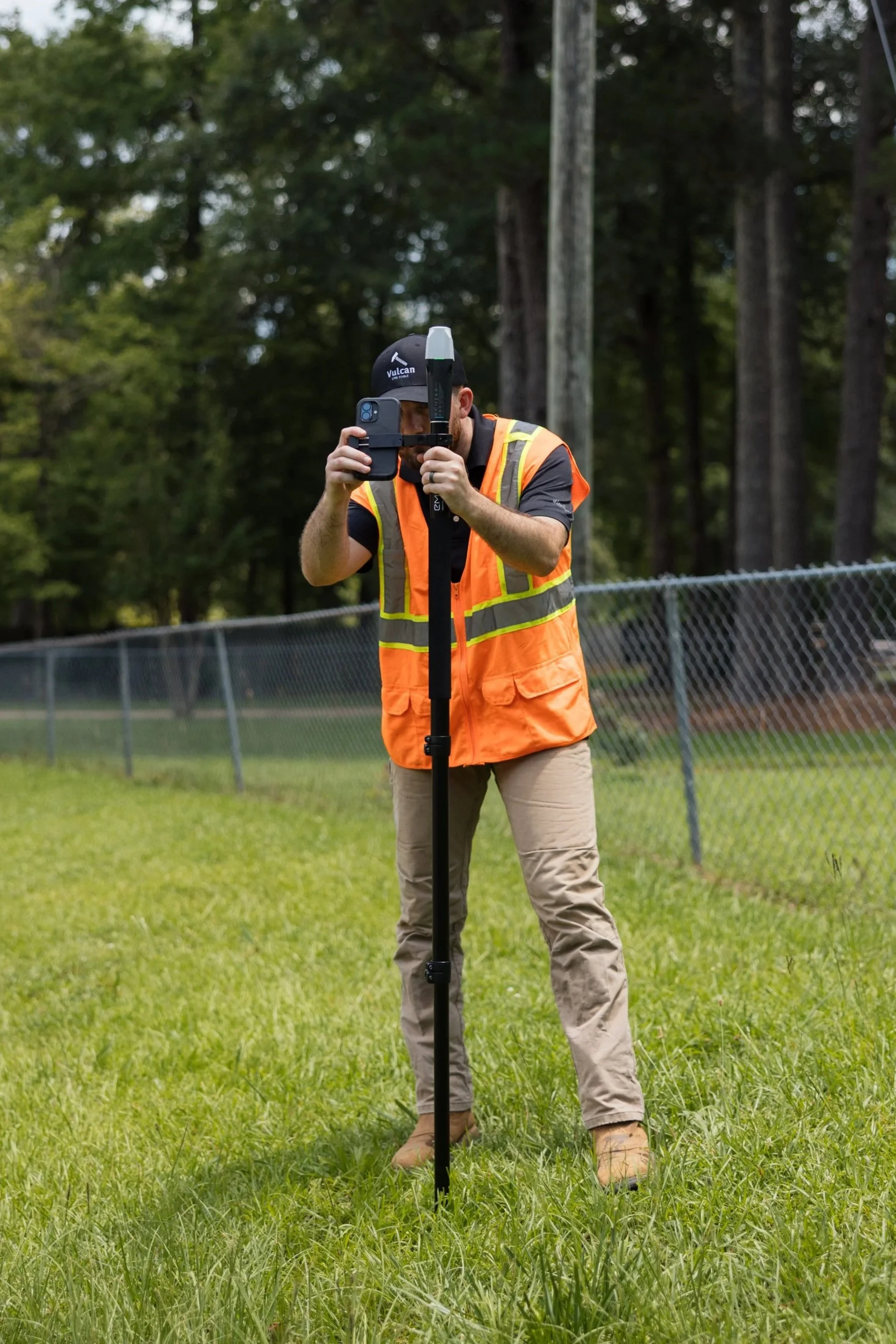
When assets are inaccessible by vehicle, Azmyth On Foot allows fielders to capture imagery and GPS data in under a minute. That data is instantaneously uploaded to Azmyth, where measurements, annotations, and validation follow the same workflow as vehicle-collected data.
This approach prioritizes:
Scalability
Measurement accuracy
GIS-ready outputs
Flexibility across overhead and underground projects
When Manual Collection
Still Matters
No method replaces boots on the ground entirely. Certain details—such as pole birthmarks or highly obstructed assets—still require close inspection.
A modern workflow acknowledges this reality by combining scalable image-based collection with targeted manual capture where needed, rather than forcing one method to do everything.
From Field Data to Engineering Decisions
Field data only becomes valuable when it is transformed into usable deliverables. Structured outputs like KML, SHP, and GeoJSON enable integration into engineering, make ready, and joint use workflows.
This is where field data connects directly to downstream processes such as:
Make Ready Assessment
An evaluation of existing utility-pole or underground infrastructure to determine what changes are needed to safely and compliantly add new communications or power facilities.
Learn More
Joint Use Auditing
A joint use audit documents and verifies all existing attachments on shared utility infrastructure to ensure they meet ownership, safety, and regulatory requirements.
Learn More