
Field Data Collection Made Simple with Azmyth on Foot

Vulcan Founder and CEO, Zac Young, shows off Azmyth on Foot
Why Precision Matters in Field Data Collection
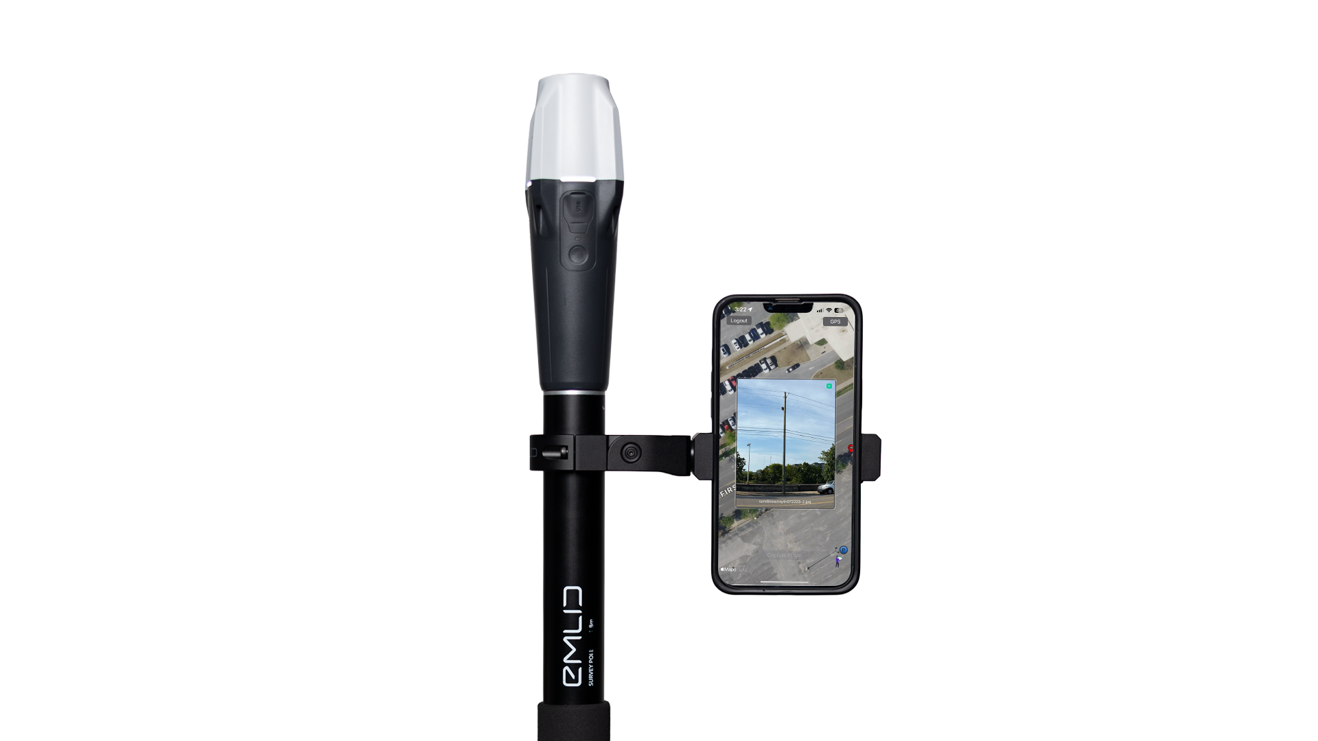
Azmyth on Foot on an iPhone, paired to an Emlid Reach RX Receiver
The power grid is uniquely challenging to survey. Power poles can sit behind fences or in dense woods, requiring surveying solutions that are both flexible and precise. In an age of unprecedented load growth on the electric grid and a national push to expand broadband, the demand for faster, more accurate workflows in infrastructure surveying is clear. Traditional surveying methods can get the job done, but they do not offer speed, flexibility, and accuracy without exceptional cost. That’s why we created Azmyth on Foot, the mobile device app that transforms your iPhone into a surveying tool without breaking the bank.
What is Azmyth on Foot?
Azmyth on Foot is an iOS and Android app that allows users to collect and upload measurable imagery into the Azmyth desktop platform. Within the platform, teams can measure an object’s location, height, attachment points, and the distance between assets. Azmyth was originally built to handle 360° imagery collected from a vehicle, but now with Azmyth on Foot, smart phone imagery can also be uploaded. This means even the most remote poles or assets can be surveyed. The app combines the convenience of manual collection with powerful backend processing, so data flows seamlessly from the field to the office.
How It Works (3 Simple Steps)
Built with simplicity in mind, workflows with the Azmyth on Foot app are easy. From collection to upload, users must follow a few basic steps to collect their data. Those steps are as follows:
Photograph the Object
Capture a photo of an object with your mobile device. The app simultaneously captures the precise GPS location of your image.Capture Precise Position
Walk to the pole or object and press a button in the app to record its exact position. Supplementary notes or photos can also be added.Save and Upload to the Desktop Platform
Save your collection and the data uploads instantly to the Azmyth desktop platform for real-time measurements and analysis.
Who It Is For
Azmyth on Foot is designed for a wide range of professionals, including utility companies and crews, telecom providers, field surveyors, and engineers. It is also a powerful tool for teams responsible for make ready assessments, infrastructure audits, or mapping assets. If your work requires precision and you want to save time and resources, Azmyth on Foot is built to deliver.
What Makes Azmyth on Foot so Accurate?

A fielder captures an image of a pole using Azmyth on Foot
Azmyth on Foot achieves horizontal accuracy within 0.5 inches by using Real Time Kinematic (RTK) positioning. RTK combines GPS satellite data with corrections from a fixed base station, eliminating errors in the signal. Fielders carry a lightweight RTK receiver (like the Emlid Reach RX) that communicates with the base station over the internet. This correction process allows Azmyth to deliver survey-grade accuracy in real time. Vertical measurements in the desktop platform are accurate within two inches, consistent with traditional surveying methods. For remote areas without reliable cellular coverage, we recommend pairing with Starlink, though the app can still capture standard GPS measurements without RTK corrections.
Key Benefits
High Accuracy: With RTK correction enabled, Azmyth on Foot can yield horizontal accuracy of 0.5 inches.
Reduced Field Overhead: Snap a photo from your iPhone or Android, capture GPS data near the object, and watch your data upload automatically to the Azmyth web app.
Real Time Data Flow and Offline Support: Collected data is uploaded from the field in real time, giving back office and engineering teams immediate visibility. If cell service is limited, Azmyth on Foot supports offline collection with later upload.
Versatile Use Cases: Designed initially for poles, but it works for any visible physical object you need to locate or measure. Hydrants, cable boxes, and signs can all be surveyed with accuracy.
Plan and Hardware
We built the app around the Emlid Reach RX receiver, which we recommend, but the platform is flexible and can handle any RTK GNSS receiver.
Subscription Plan: Azmyth on Foot is available at $100 per month. This includes all the features of the Standard Azmyth plan plus unlimited image uploads and RTK corrected data.
Required Hardware: The Emlid Reach RX (GNSS receiver) is the supported GPS unit. It provides high accuracy data when paired with the app. Users also need a smartphone (iPhone, Android, etc.).
For More Information
To purchase a subscription or order hardware, please visit our Azmyth on Foot page for more info.
For general information about the Azmyth desktop platform, please visit our Azmyth page here.
You can also get in touch with us by clicking the button below!